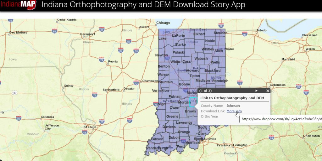
Countywide DEM Mosaics
County-based Ortho & LiDAR Mosaics have become very popular products for users of Indiana’s GIS data, so IGIC in collaboration with the Indiana’s GIO Office has released an app for anyone to easily access and download the newest County Orthoimagery and Digital Elevation Model (DEM) Mosaics for the State of Indiana. Indiana’s newest digital imagery was collected from 2016 to 2019, and Indiana’s newest 3DEP digital elevation data is being collected from 2016 to 2020. |