- Home
- About Us
- Membership
- 2025 GIS Conference
- Events
- Resources
- Forums
|
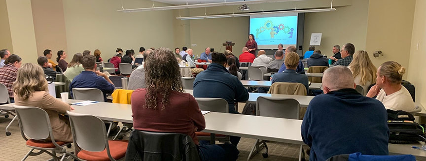
On October 18, IGIC held its annual Indiana Government Geospatial Coordinator’s Forum. The event took place from 9:00 am to 3:00 pm eastern at The Pyramids at College Park, Building #3 (3500 DePauw Blvd, Indianapolis). Registration was free and includes breakfast and lunch.
The Forum will begin with updates from the Geographic Information Office and the Indiana Geographic Information Council. Much of the morning will be dedicated to a discussion about how to leverage the Indiana Data Harvest and IndianaMap toward improving data sharing as well as a wide range of regional, state and local data supported services across the State. Participants will be invited to offer insights about benefits as well as challenges associated with this strategy. Be sure your community is represented in this important conversation by attending the Forum. Following our lunch break we will separate into two groups. One will discuss issues of interest to county government and the other will focus on cities and towns. This is your opportunity to learn from and collaborate with your peers from across the state about opportunities and best practices you can apply in your community.
Thank You 2022 Forum Sponsors! 9:00 to Noon
Noon to 1:00 – Lunch 1:00 to 3:00
3:00 Adjourn |